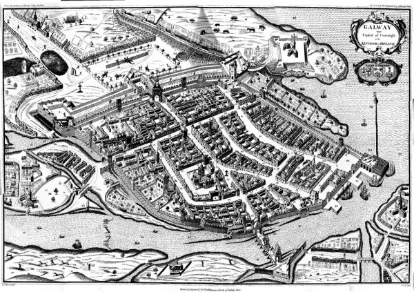
This map of 1651 shows the walled city (North is to the left). The River Corrib is in the foreground, crossed by what is now "O´Briens Bridge", leading to Salthill.
This census records system has been replaced with a newer version available at https://nationalarchives.ie/collections/search-the-census/ and will be coming offline in the coming months. Any updates made to the data will only be reflected in the new system and there will be no automated links established between the old and new census systems. Please ensure you make all necessary arrangements as soon as possible.